ENPHO (2023) SFD (level 2) Report - Siraha Municipality, Nepal
Siraha municipality is in southern terai region of Nepal. The municipality was restructured in 2016 by merging former village development committees namely Lagadigadiyani, Laxminiya, Samhaitha, lagadigoth and Hakpara in Siraha Municipality. The municipality is divided into 22 political ward boundaries. The total population of the municipality is 96,543 as per the preliminary report of census 2021. The total population was 98,393 residing in 17,828 households as […]
Online since: 07.02.2023
Views: 1129
Downloads: 1801
(2021) SFD (Lite) Report - Odagaon, India
Odagaon is a town and Notified area council (geographical coordinates as 20°00'57.65"N 84°59'15.70"E) in the Nayagarh district of Odisha, India. It is around 100km away from the capital city of Bhubaneswar. As per Census of India, 2011, Odagaon Urban has the population of 5,401 with 1,240 households. As nearby rural areas have been included in new jurisdiction boundary, the population as of 2011 as by […]
Online since: 31.01.2023
Views: 1049
Downloads: 53
Peter Morgan (2023) The Ventilated Arborloo
The Arborloo is a simple pit toilet using a shallow unlined pit between 1m and 2m deep, depending on soil type and firmness, which is protected at the surface with a ring beam made of concrete or cemented fired bricks. When the excreta is mixed with soil, leaves and ash the pit contents slowly change into a medium in which plants can grow. When the […]
Online since: 25.01.2023
Views: 957
Downloads: 73
(2022) Menstrual Health and Hygiene - Leave No One Behind in South Asia
“Achieving menstrual health requires access to information about the menstrual cycle and self-care, materials, water and sanitation facilities and services to care for the body during menstruation, access to timely diagnosis, care and treatment for menstrual discomforts and disorders, a positive and respectful environment free from stigma, and the freedom to participate in all spheres of life throughout the menstrual cycle” (Hennegan et al, 2021) Remarkable […]
Online since: 18.01.2023
Views: 1157
Downloads: 98
(2022) Managing the WASH Emergency Response and Recovery in the Aftermath of Cyclone Fani
Cyclone Fani hit Odisha on 3 May 2019. The UNICEF WASH team witnessed that the wind speeds were unprecedented and highly destructive, devastating 14 districts. It was found that among the most affected were villages in Puri district. To address this massive emergency, the WASH team at UNICEF Odisha, immediately started working with other organizations to support the government in effectively coordinating efforts to provide […]
Online since: 18.01.2023
Views: 673
Downloads: 1084
(2022) Supporting Hygiene Promotion and Menstrual Hygiene Management After Cyclone Fani
In the aftermath of Cyclone Fani, villages in Odisha were affected with a wide variety of challenges including increased open defecation, damage to toilets and latrines, the loss of key hygiene items, and the contamination of drinking water. The UNICEF WASH team in Odisha held participatory discussions with community members in 20 villages, including Badabenakudi, which revealed that there was an insufficient understanding of the […]
Online since: 18.01.2023
Views: 834
Downloads: 34
(2022) Fit for School Initiative for Africa - South Sudan materials
Collection of Fit for School Initiative for Africa materials, for South Sudan
Online since: 18.01.2023
Views: 867
Downloads: 1788
(2022) Fit for School Initiative for Africa - Malawi materials
Collection of Fit for School Initiative for Africa materials, for Malawi.
Online since: 18.01.2023
Views: 823
Downloads: 771
(2022) SFD (Lite) Report - Saint Mary, Jamaica
Saint Mary is a rural parish located on the Caribbean island of Jamaica. The geographical coordinates of Saint Mary are latitude 18°09' north and longitude 77°03' west. Saint Mary is the fifth smallest parish on the island and its capital is Port Maria. The parish is located on the north eastern coast of the island and has an area of 611.3 km2. Jamaica is divided […]
Online since: 16.01.2023
Views: 1049
Downloads: 1681
(2022) SFD Comprehensive Report - Liberia, Costa Rica
The site for this study, Liberia, is the first district and capital city of the canton of Liberia, in the province of Guanacaste, Costa Rica. It is located in the northwest corner of the country. Liberia is divided into five districts; Cañas Dulces, Curubandé, Liberia, Mayorga and Nacascolo. The Liberia district is the largest, covering an area of 561.57 km2. The district has experienced rapid […]
Online since: 16.01.2023
Views: 1088
Downloads: 78
(2022) SFD Comprehensive Report - San Pablo, Costa Rica
The canton of San Pablo is located in the central zone of the Greater Metropolitan Area (GAM) of the Central Valley of Costa Rica, in the province of Heredia, covering an area of 7.53 km2. The population is subdivided into two districts; San Pablo (70%), and Rincón de Sabanilla (30%). San Pablo is fully (100%) urbanized with one of the 10 highest population densities in […]
Online since: 16.01.2023
Views: 1167
Downloads: 73
(2022) SFD Intermediate Report - Dipayal Silgadhi Municipality, Nepal
Dipayal Silgadhi municipality is the district headquarters of Doti District in Sudurpashchim Province of Nepal. The former district headquarters of Far Western Development Region, Dipayal Silgadhi lies in the lesser Himalayas on the bank of Seti River at 29°16′N 80°56′E. The municipality comprises nine wards, the smallest local government unit. (Municipality, 2018). The total population of the municipality is 32,941, with male and female population percentage […]
Online since: 12.01.2023
Views: 1622
Downloads: 2629
(2022) SFD Intermediate Report - Badimalika, Nepal
Badimalika Municipality lies in Bajura District in Sudurpaschim Province of Nepal. It was established in March 2017 in accordance with the 2015 Nepali Constitution, as decided by the cabinet. It is formed by merging previously three Village Development Committees (VDCs) named Martadi, Budiganga and Jugada. There are nine political wards in the municipality. Population of Municipality is 17,227, with 8,852 male and 8,375 female. Ward 9 […]
Online since: 12.01.2023
Views: 1332
Downloads: 142
(2022) SFD Intermediate Report - Patan Municipality, Nepal
Patan Municipality is in Baitadi District, Sudurpaschim Province of Nepal. The municipality is extended to 219.26 km2. It is divided into 10 wards. The municipality is surrounded by Sigas rural municipality in the east, Dashrathchand municipality and Melauli in the west, Surnava and Dogada rural municipality in north and Dadeldhura district in the south. According to Census 2011, the municipality has a total population of […]
Online since: 09.01.2023
Views: 1286
Downloads: 98
(2022) SFD (Lite) Report – Gazipur, Bangladesh
Gazipur is a fast-growing city, which is 25 km away from the Dhaka city. It is beside the Turag and Balu Rivers and it is well connected with road, water, and railways. It is one of the oldest towns in the sub-continent and was declared City Corporation in 2013. Gazipur is one of the 12 City Corporation in the country. According to the population census in […]
Online since: 16.12.2022
Views: 1288
Downloads: 101
(2022) SFD (Lite) Report - Gopalganj Municipality, Bangladesh
Gopalganj is a fast-growing city located along the Dhaka-Khulna highway and 209 km South of Dhaka. It is beside the Kaliganga River and it is well connected with road, water, and railways. It is one of the oldest towns in the sub-continent and was declared a municipality in 1972. Gopalganj is one of the 53 district level municipality in the country. According to the population census […]
Online since: 16.12.2022
Views: 1301
Downloads: 107
(2022) SFD (Lite) Report – Feni, Bangladesh
Feni is a fast-growing city located along the Dhaka-Chittagong highway and 161 km South of Dhaka. It is besides the Selonia River and it is well connected with road, water, and railways. It is one of the oldest towns in the sub-continent and was declared a Municipality in 1958. Feni is one of the 53 district level Municipality in the country. According to the population census […]
Online since: 16.12.2022
Views: 1362
Downloads: 80
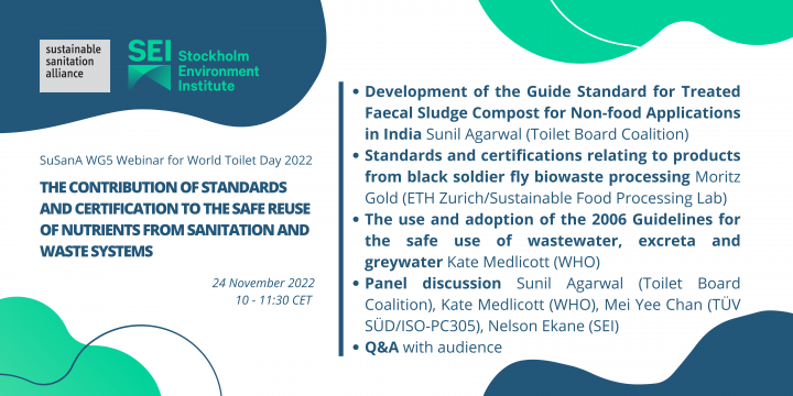
SuSanA (2022) WG5 Webinar: The contribution of standards and certification to the safe reuse of nutrients from sanitation and waste systems
To commemorate World Toilet Day 2022, the SuSanA Working Group on productive sanitation and food security (WG5) and the Stockholm Environment Institute (SEI), along with partners, organised a webinar about the role of standards and certification systems in the safe reuse of nutrients from sanitation systems. Moderated by WG5 Lead Daniel Ddiba. This entry is the collection point of the different resources from the webinar, including […]
Online since: 25.11.2022
Views: 1340
Downloads: 2365
CWIS-FSM Support Cell, DPHE (2022) SFD Lite Report – Bhola Municipality, Bangladesh (vn 2022)
Bhola is a fast-growing city, which is 185 km away from the Dhaka city. It is beside the Megna and Tetulia River and well connected with road and water. It is one of the oldest towns in the sub-continent and was declared Municipality in 1920. Bhola is one of the 53 district level Pourashava in the country. According to the population census in 2011 by the […]
Online since: 16.11.2022
Views: 1416
Downloads: 2295
SCBP, NIUA (2022) SFD Lite Report – Dehradun, India
Dehradun Nagar Nigam area1 is 100 km2. and has 100 wards with a population of 804,3792 (as of 2018). There are 167,577 households (HHs) (after municipal boundary expansion in 2018) within municipal boundary; this suggests the average household size in the city to be 5. The output of the SFD graphic represents that 46% of the human excreta flow is attributed to be safely managed and […]
Online since: 16.11.2022
Views: 1363
Downloads: 2207